West Papua usually refers to the western half of the island of New Guinea, which is part of Indonesia and has had six provinces since 2022. By contrast, the eastern half of the same island is Papua New Guinea (PNG), an independent country since 1975. A land border of about 824 kilometres separates the two.
Where exactly is West Papua?
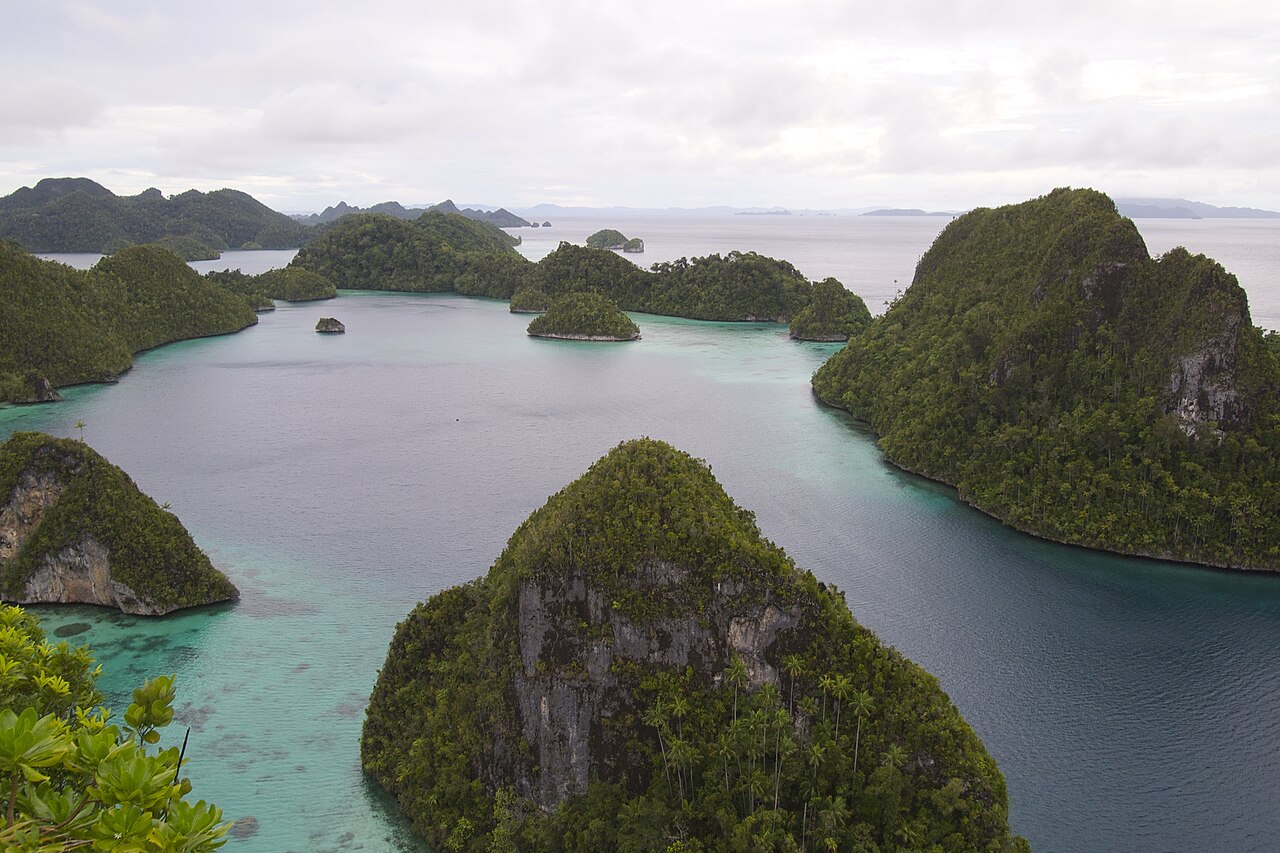
New Guinea is a large island just north of Australia. In particular, its western half, often called West Papua, Western New Guinea or Indonesian Papua, covers about 412,000 square kilometres and had about 5.6 million people in 2023, according to Indonesia’s statistics agency (BPS). It also includes the Raja Ampat and Biak islands off its north-west coast.
However, the name can be confusing. “West Papua” is also the English name of one of the six provinces (Papua Barat, capital Manokwari), and it is the name used by Papuan independence campaigners for the whole region. Indonesia’s government, on the other hand, refers to the region by its provincial names. In Papua Movement’s explainers, “West Papua” means the whole region unless we name a single province.
👉 ALSO READ: How Did Papua Become Part of Indonesia?
What are the six Papuan provinces of Indonesia?
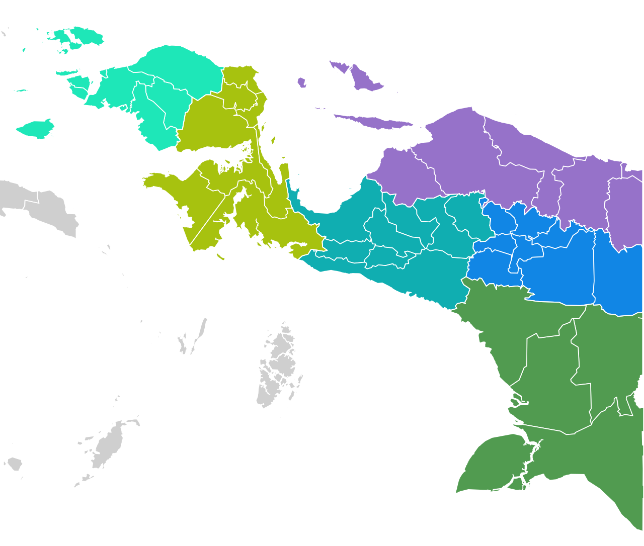
Until 2022 the region had two provinces, Papua and West Papua. Then, in June 2022, Indonesia’s parliament passed laws creating Central Papua, Highland Papua and South Papua (Reuters), and later, in December 2022, Southwest Papua became Indonesia’s 38th province under Law No. 29 of 2022 (Antara; Cabinet Secretariat). However, some Papuan groups opposed the new provinces, while the government says they will bring services closer to communities.
| Province (Indonesian name) | Capital | Population (2023) |
|---|---|---|
| Papua (Papua) | Jayapura | 1.09 million |
| West Papua (Papua Barat) | Manokwari | 0.57 million |
| Southwest Papua (Papua Barat Daya) | Sorong | 0.61 million |
| Central Papua (Papua Tengah) | Nabire | 1.36 million |
| Highland Papua (Papua Pegunungan) | Wamena (Jayawijaya) | 1.46 million |
| South Papua (Papua Selatan) | Merauke | 0.53 million |
Population: BPS figures as compiled in public references, 2023.
How is West Papua different from Papua New Guinea?
| West Papua (Indonesia) | Papua New Guinea | |
|---|---|---|
| Status | Six provinces of Indonesia | Independent country since 16 September 1975 |
| Capital | Jakarta (national); provincial capitals above | Port Moresby |
| Population | About 5.6 million (2023) | About 10.2 million (2024 census) |
| Main languages | Indonesian, plus hundreds of local languages | English, Tok Pisin and Hiri Motu, plus hundreds of local languages |
| Currency | Indonesian rupiah | Papua New Guinean kina |
PNG’s National Statistical Office published the final 2024 census figures with support from the UN Population Fund (UNFPA). However, some officials in PNG have questioned the count.
Why is New Guinea divided between two countries?
Put simply, the split dates from the colonial era. First, the Netherlands claimed the western part of New Guinea in 1828. Then, in 1884, Germany took the north-east and Britain the south-east. After that, an 1895 treaty between Britain and the Netherlands fixed the boundary in roughly its current place. Later, the eastern half came under Australian administration and became independent as Papua New Guinea in 1975 (border history).
Meanwhile, the western half stayed Dutch after Indonesia’s independence in 1949. Subsequently, under the New York Agreement of 15 August 1962, it passed to a temporary UN administration (UNTEA) on 1 October 1962 and to Indonesia on 1 May 1963 (United Nations). Finally, in 1969, just over 1,000 selected representatives voted for integration with Indonesia in the “Act of Free Choice”, and the UN General Assembly took note of the result in Resolution 2504 (UN Digital Library). Indonesia’s government therefore considers the question settled. However, many Papuans and independent observers dispute whether the vote reflected the people’s wishes. For more detail, see How Did Papua Become Part of Indonesia?
Does Indonesia own half of Papua New Guinea?
No. In fact, Indonesia and Papua New Guinea are separate countries that share the island of New Guinea. In other words, Indonesia governs the western half of the island, while Papua New Guinea governs the eastern half plus many smaller islands, including New Britain and Bougainville.
Where is the border, and can you cross it?
Specifically, the 824-kilometre border runs in two straight north–south lines along the 141st meridian east, joined by a short stretch that follows the Fly River. In this way, it separates the Indonesian provinces of Papua, Highland Papua and South Papua from PNG’s Sandaun and Western provinces. However, there is only one official crossing point for travellers, between Skouw near Jayapura in Indonesia and Wutung near Vanimo in PNG.
Sources
- United Nations Peacekeeping: United Nations Security Force in West New Guinea (UNSF) – Background
- UN Digital Library: A/RES/2504(XXIV), Agreement between Indonesia and the Netherlands concerning West New Guinea (West Irian), 1969
- Reuters: Indonesia passes contentious law to create more provinces in Papua (30 June 2022)
- Antara: Southwest Papua officially becomes Indonesia’s 38th province (9 December 2022)
- Cabinet Secretariat of the Republic of Indonesia: Home Minister inaugurates new province in Papua
- UNFPA Papua New Guinea: 2024 National Population Census Final Figures
- Wikipedia: Indonesia–Papua New Guinea border
Featured image: Map of Indonesia’s Papuan provinces and regencies (2023). Map: Envapid / Wikimedia Commons, CC BY-SA 4.0.